
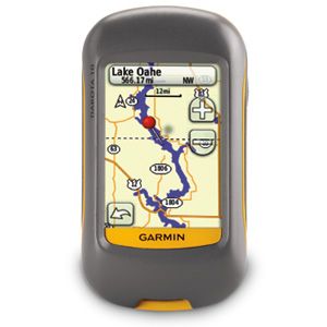
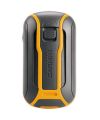

Handheld GPS Garmin Dakota 10
Outdoor navigation meets touchscreen simplicity in Dakota 10. This rugged, palm-sized navigator boasts touchscreen navigation, high-sensitivity GPS with HotFix™ satellite prediction, and a worldwide basemap in one affordable, power-packed punch.
Touch and Go
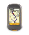
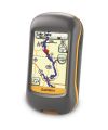
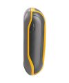
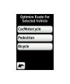
Dakota 10 makes outdoor navigation effortless with a tough, sunlight-readable, 2.6 inch color touchscreen display. The interface is easy to use, so you’ll spend more time enjoying the outdoors and less time searching for information. Both durable and waterproof, Dakota 10 is built to withstand the elements: bumps, dust, dirt and water are no match for this rugged navigator. And with its high-sensitivity, WAAS-enabled GPS receiver with HotFix™ satellite prediction, Dakota 10 locates your position quickly and precisely and maintains its GPS location even in heavy cover and deep canyons.
Find Fun
Get into paperless geocaching with Dakota 10 by quickly downloading up to 2,000 caches, with information such as location, terrain, difficulty, hints and description — no more paper print outs and manually entered coordinates. Visit our geocaching pages for more information.
Explore the Terrain
Dakota 10 comes with built-in worldwide basemap, so you can navigate anywhere with ease. Adding more maps is easy with Garmin's wide array of detailed topographic, Ordnance Survey®, marine charts and road maps, which can be loaded to internal memory.
Dakota 10: Touchscreen navigation for the great outdoors.
Specifications
Physical & Performance: |
|
| Unit dimensions, WxHxD | 2.2" x 3.9" x 1.3" (5.5 x 10 x 3.3 cm) |
| Display size, WxH | 1.43" x 2.15" (3.6 x 5.5 cm); 2.6" diag (6.6 cm) |
| Display resolution, WxH | 160 x 240 pixels |
| Display type | Transflective colour TFT touchscreen |
| Weight | 5.25 oz (148.8 g) with batteries |
| Battery | 2 AA batteries (not included); NiMH or Lithium recommended |
| Battery life | 20 hours |
| Waterproof | Yes (IPX7) |
| Floats | No |
| High-sensitivity receiver | Yes |
| Interface | USB |
Maps & Memory: |
|
| Basemap | Yes |
| Preloaded maps | no |
| Ability to add maps | Yes |
| Built-in memory | 850 MB |
| Accepts data cards | no |
| Waypoints/favorites/locations | 1000 |
| Routes | 50 |
| Track log | 10,000 points, 200 saved tracks |
Features & Benefits: |
|
| Automatic routing (turn by turn routing on roads) | Yes (with optional mapping for detailed roads) |
| Electronic compass | No |
| Touchscreen | Yes |
| Barometric altimeter | No |
| Camera | no |
| Geocaching-friendly | Yes (Paperless) |
| Custom maps compatible | Yes |
| Photo navigation (navigate to geotagged photos) | No |
| Hunt/fish calendar | Yes |
| Sun and moon information | Yes |
| Tide tables | No |
| Area calculation | Yes |
| Custom POIs (ability to add additional points of interest) | Yes |
| Unit-to-unit transfer (shares data wirelessly with similar units) | No |
| Picture viewer | No |
| Garmin Connect™ compatible (online community where you analyze, categorize and share data) | Yes |
| Additional |
This USB mass storage device is compatible with Windows® XP or newer and Mac® OS X 10.4 or later. |
| Brand | GARMIN |
|---|